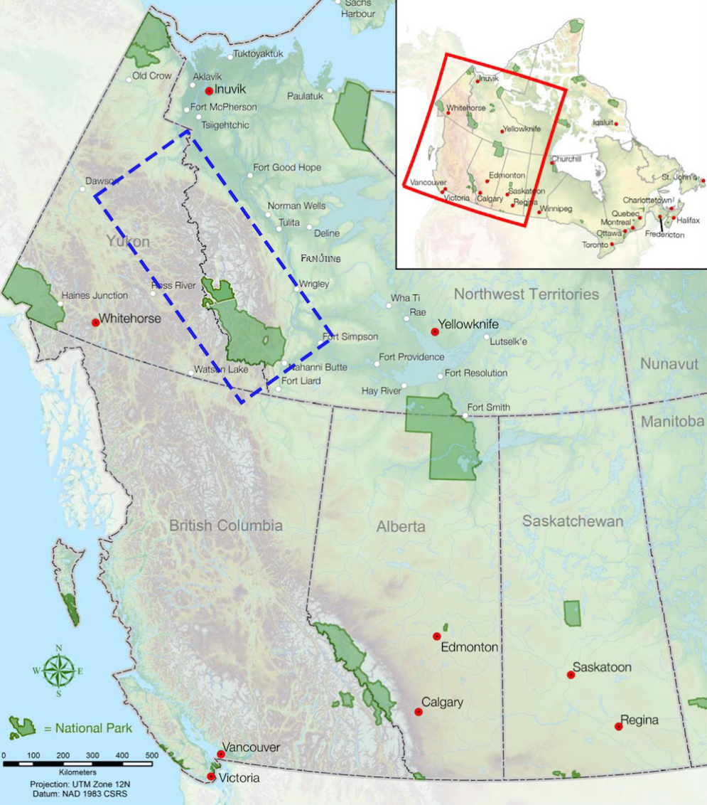
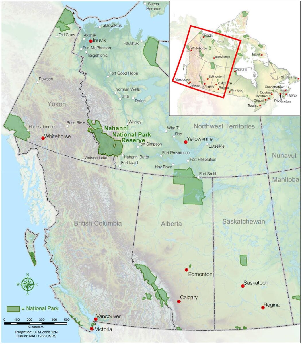
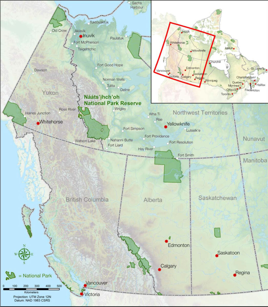
The Mackenzie Mountain Range is a dream destination for paddlers across the globe seeking remote mountain rivers in Northern Canada. The range is located along the Northwest Territories and Yukon border spanning 800km (497 mi) southeast-northwest along the border and covering an area of 331,000 km² (128,000 mi²). The range is a major watershed for many northern rivers and divides the Yukon River Basin, to the west, from the Mackenzie River Basin, to the east.
Within the mountain range, there are two protected regions: UNESCO World Heritage Site Nahanni National Park Reserve and Nááts’ihch’oh National Park Reserve.
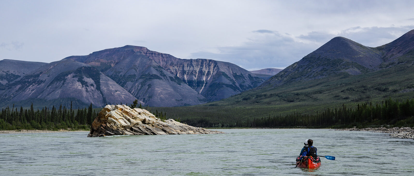
The area is known for remote paddling and hiking adventures, abundant wildlife and spectacular mountainous views.
In the image below, the blue dashed line shows the approximate boundary of the Mackenzie Mountain Range.
The Mackenzie Mountains have been home to Indigenous peoples for thousands of years. The Shotah Dene, Dehcho First Nations, Sahtu Dene and Métis, Gwich’in, Tetlit Gwich’in, Kaska Dene and Ross River Dena Council have deep cultural connections to the mountains, rivers and wildlife of this region and continue to be stewards of these lands.
Today, traditional hunting, fishing, trapping and gathering still take place on this land with multiple indigenous councils actively involved in co-management of the protected areas within the Mackenzie Mountains.
Take the time to watch one example of traditional land use within the Mackenzie Mountain Range by the Shotah Dene people as Gabe Etchinelle leads a project of a mooseskin boat construction to travel down the Keele River. Film provided by the National Film Board of Canada.
Alexander Mackenzie (Late 1700s): In the 18th century, Alexander Mackenzie arrived in the region seeking a route to the Pacific along the Deh Cho (Mackenzie River). Though he never ventured into the Mackenzie Mountains, the range was later named after him. Indigenous guides from the region played essential roles in these exploratory expeditions.
The Fur trade Era (Early 1800s): The fur trade brought significant change to the region in the early 1800s. Trading posts were established along the Deh Cho (Mackenzie River) to the east of the mountain range. Rivers flowing from the Mackenzie mountains were used as trade routes, often using moose skin boats to bring furs toward the Deh Cho (Mackenzie River) to trade.
Gold Rush and Mapping (Early 1900s): The Klondike Gold Rush of the 1890s pushed exploration beyond the Yukon. Prospectors travelled into the Mackenzie Mountains in search of gold and other minerals, leading to early systematic mapping in the region.
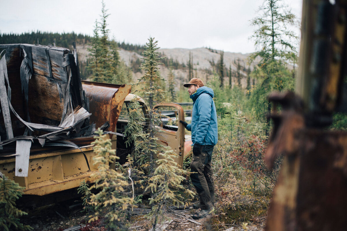
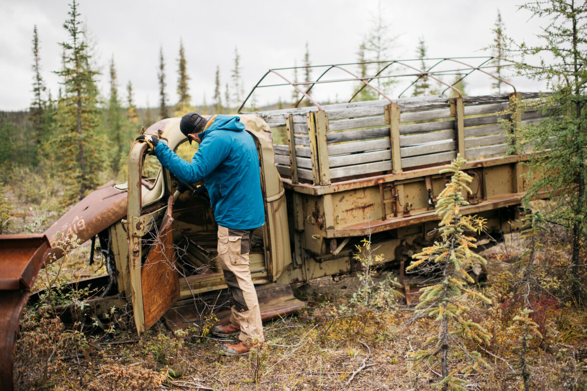
Canol Trail (Mid 1900s): In WWII, due to a threat of a fuel shortage in Alaska and the North American west coast, a pipeline was built through the Mackenzie Mountains beginning, to the east, in Norman Wells and ending, to the west, the Yukon border. This pipeline was built remarkably quickly but operated for less than one year before it was abandoned. Now, it exists as a challenging, rugged, 355 km (220 mi) hiking or biking route through the region with many signs of the rapid build still present such as vehicles and segments of pipeline.
Mineral exploration for zinc, lead, tungsten and gold within the mountain range led to a need for environmental conservation efforts to create protected regions within the mountain range.
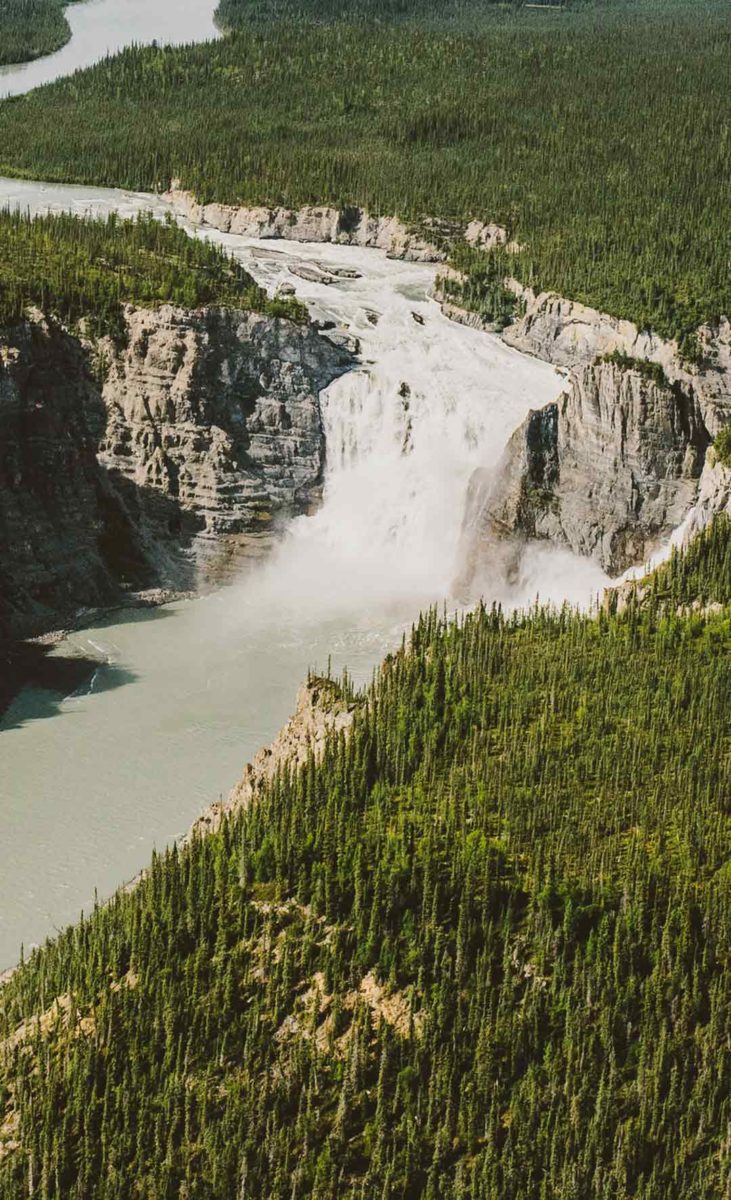
In 1972, the Nahanni National Park (Nah?ą Dehé) was created, covering an area of 4766 km² (1840 mi²). Just 6 years later, the park was declared a UNESCO World Heritage Site. In 2009, the park was expanded to include Virginia Falls (a remarkable waterfall that almost doubles the height of Niagara Falls), the Ram Plateau, the North Nahanni Karst (the Northwest Territories’ largest glaciers and key habitat areas for grizzly bears and woodland caribou) and resulted in a new protected area covering 30,000 km² (11,583 mi²).
In 2014, a second protected area was declared within the mountains called Nááts’įhch’oh National Park Reserve and covers 4895 km² (1890 mi²). This region protects the headwaters of the Nahanni River and vital regions for wildlife habitat.
Both parks operate under co-management agreements: Nahanni Park Reserve is co-managed by the Dehcho First Nations, Nahʔą Dehé Dene Band and Parks Canada, while Nááts’įhch’oh National Park Reserve is co-managed by the Sahtu Dene and Métis and Parks Canada.
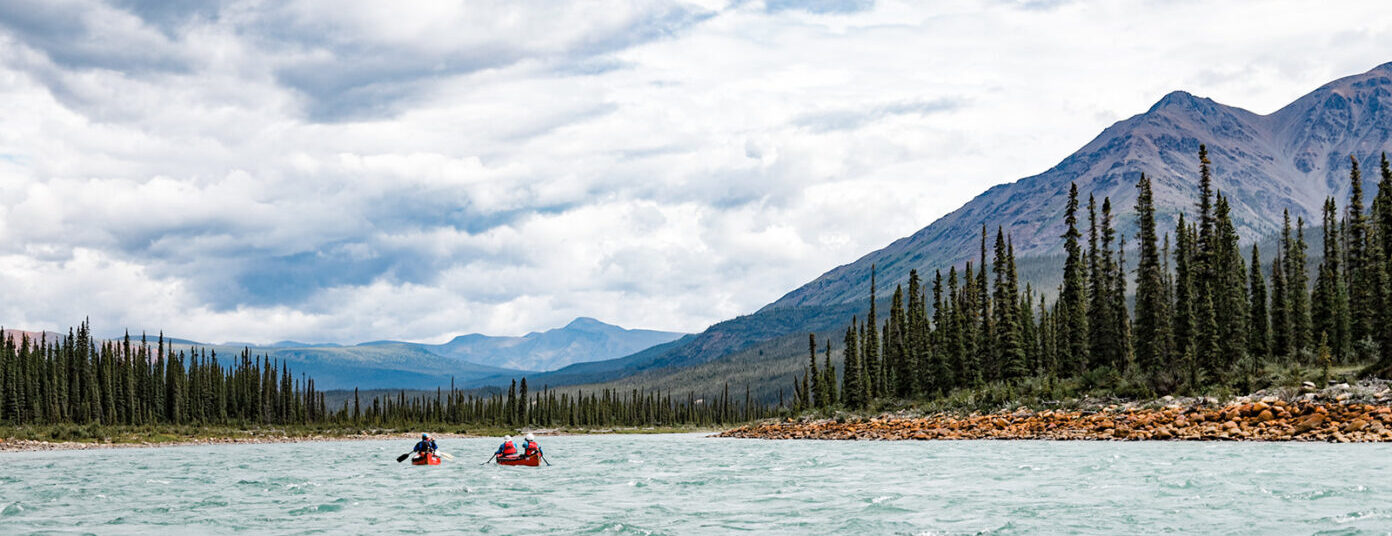
There are a multitude of rivers within the Mackenzie Mountain Range that encompass every level of thrill for paddlers of all levels. This is simply three of the better known paddling routes but by no means an extensive list of the paddling routes of the area.
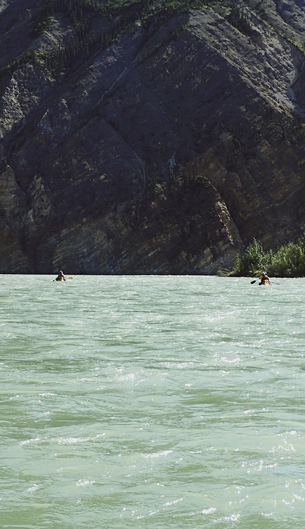
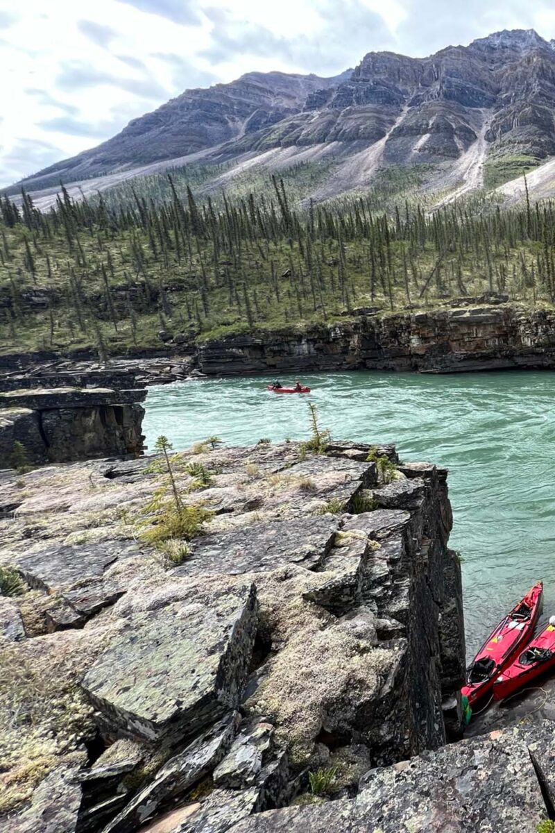
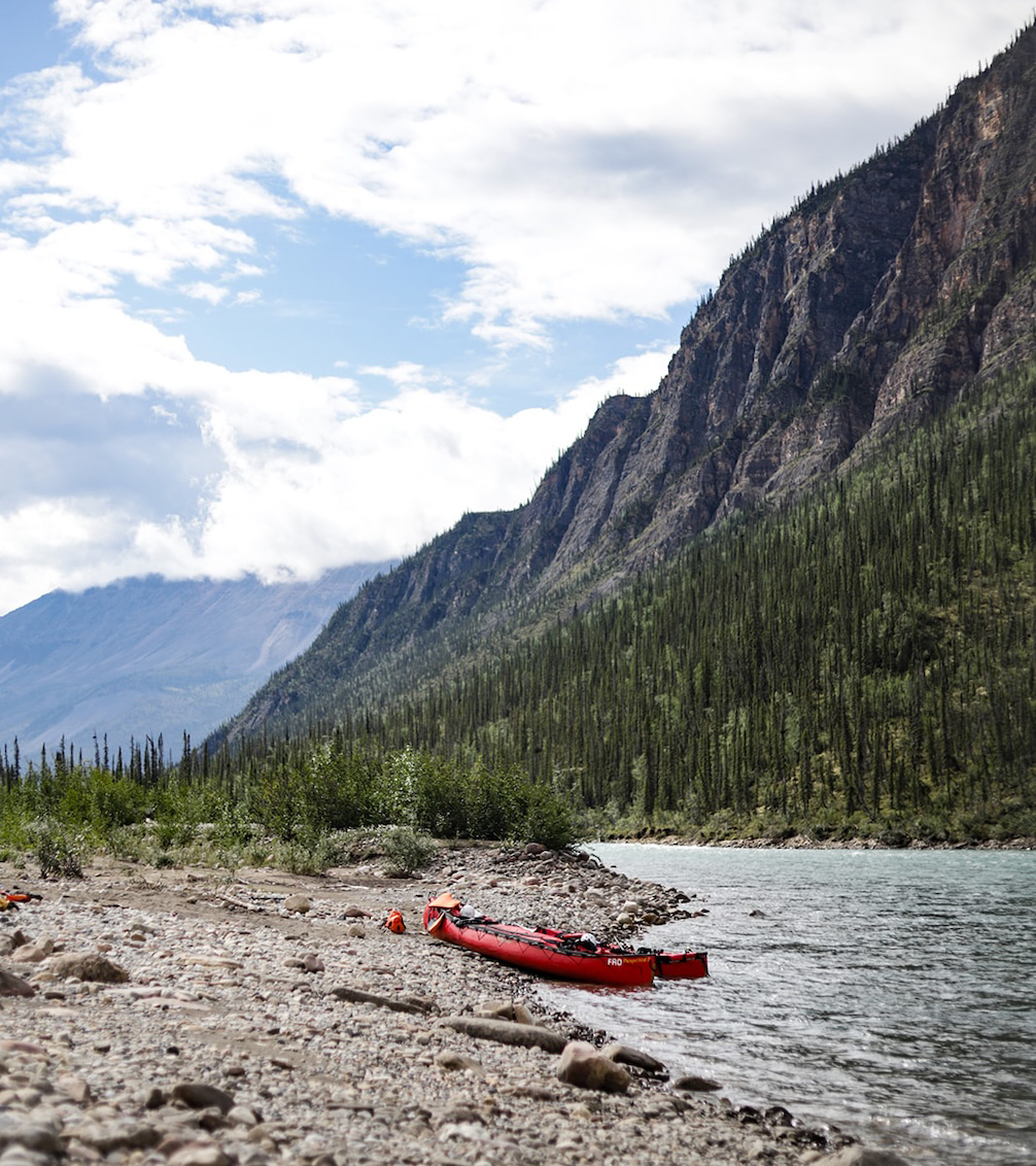
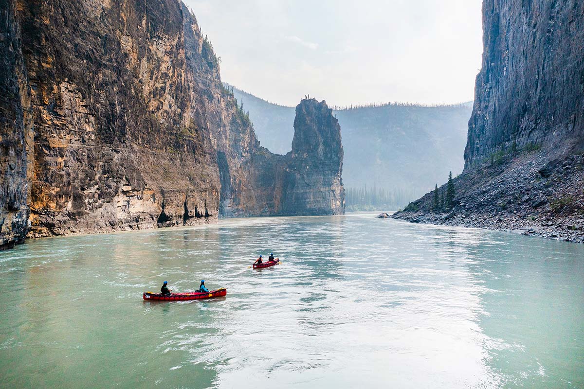
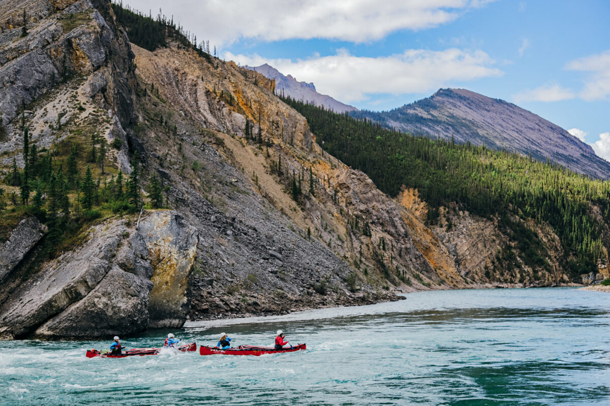
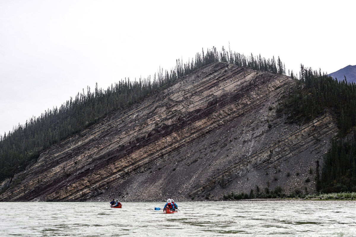
The iconic Nahanni River, flowing through the Nahanni National Park Reserve offers visitors a variety of scenery and whitewater that is renowned in the paddling world.
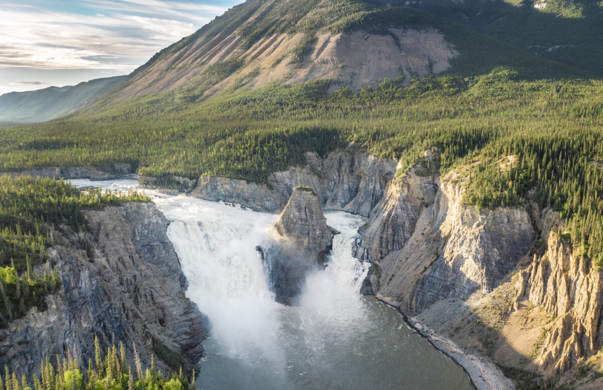
The route offers both steep canyon sections with technical whitewater and mellow stretches with hot springs for a restful break. A significant highlight of the route is the chance to take in the thundering Virginia Falls standing nearly twice the height of Niagara Falls. Beyond the falls, you’ll navigate spectacular canyons, each with unique geological features and exciting rapids.
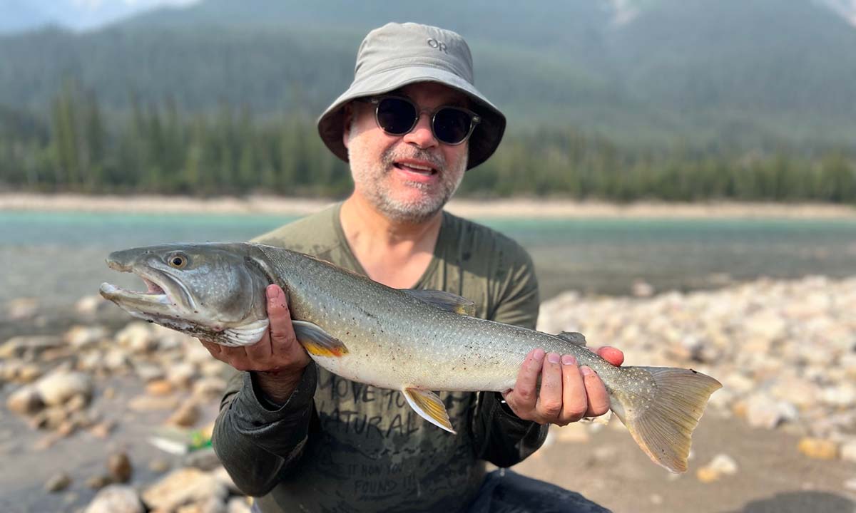
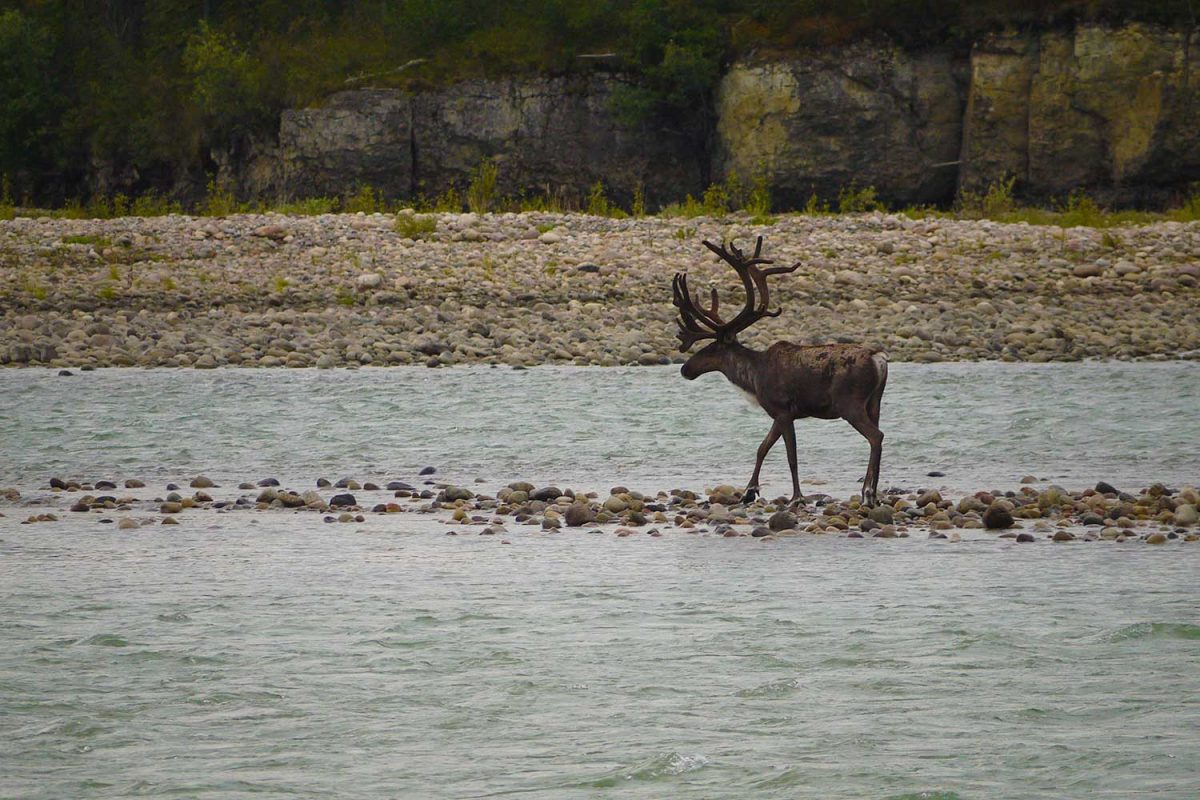
As you travel, keep an eye out for Dall sheep on cliffsides, grizzly bears along the shoreline and caribou in the valleys. For those looking to fish, there is a high chance of catching arctic grayling, northern pike, bull trout and lake trout throughout your journey.
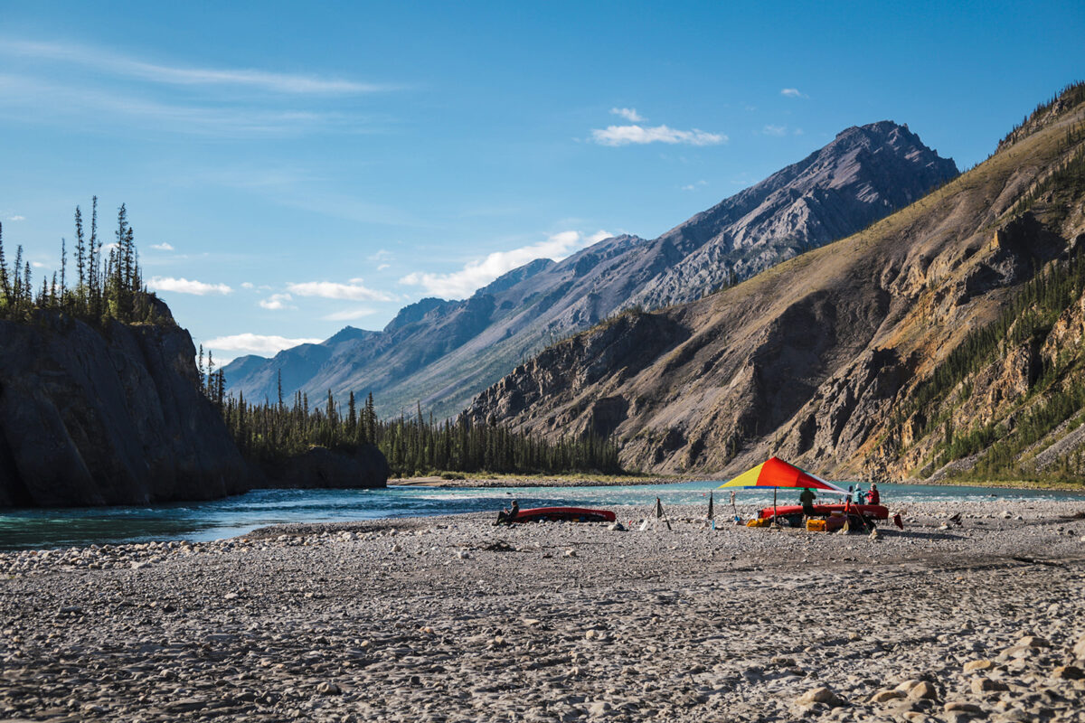
With expansive gravel bar campsites and natural hot springs along the route, the Nahanni River offers a balance of adventure and relaxation.
This journey through the Mackenzie Mountains delivers thrilling whitewater through dramatic northern scenery. You’ll experience the river growing from the starting point of O’Grady Lake into a striking blue-green river carving through the mountains.
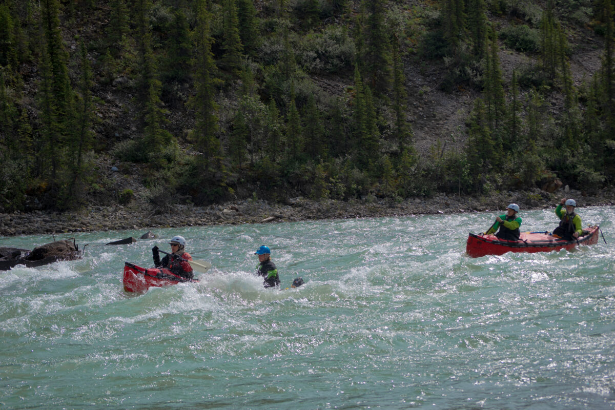
Experienced paddlers will find plenty of challenge in the technical rock gardens and canyon sections, culminating in the renowned Stelfox Canyon. Quieter stretches offer wide mountain valleys where caribou, moose, mountain goats and grizzlies can be spotted.
Bring your fishing rod to cast for arctic grayling and bull trout hiding below the surface of this beautiful waterway.
For those who want to keep going, you may continue 300 km (186 mi) down the Keele River to the mighty Deh Cho (Mackenzie River) to get the full visual experience of high mountains and narrow valleys to the expansive Mackenzie lowlands that the Mackenzie River flows through.
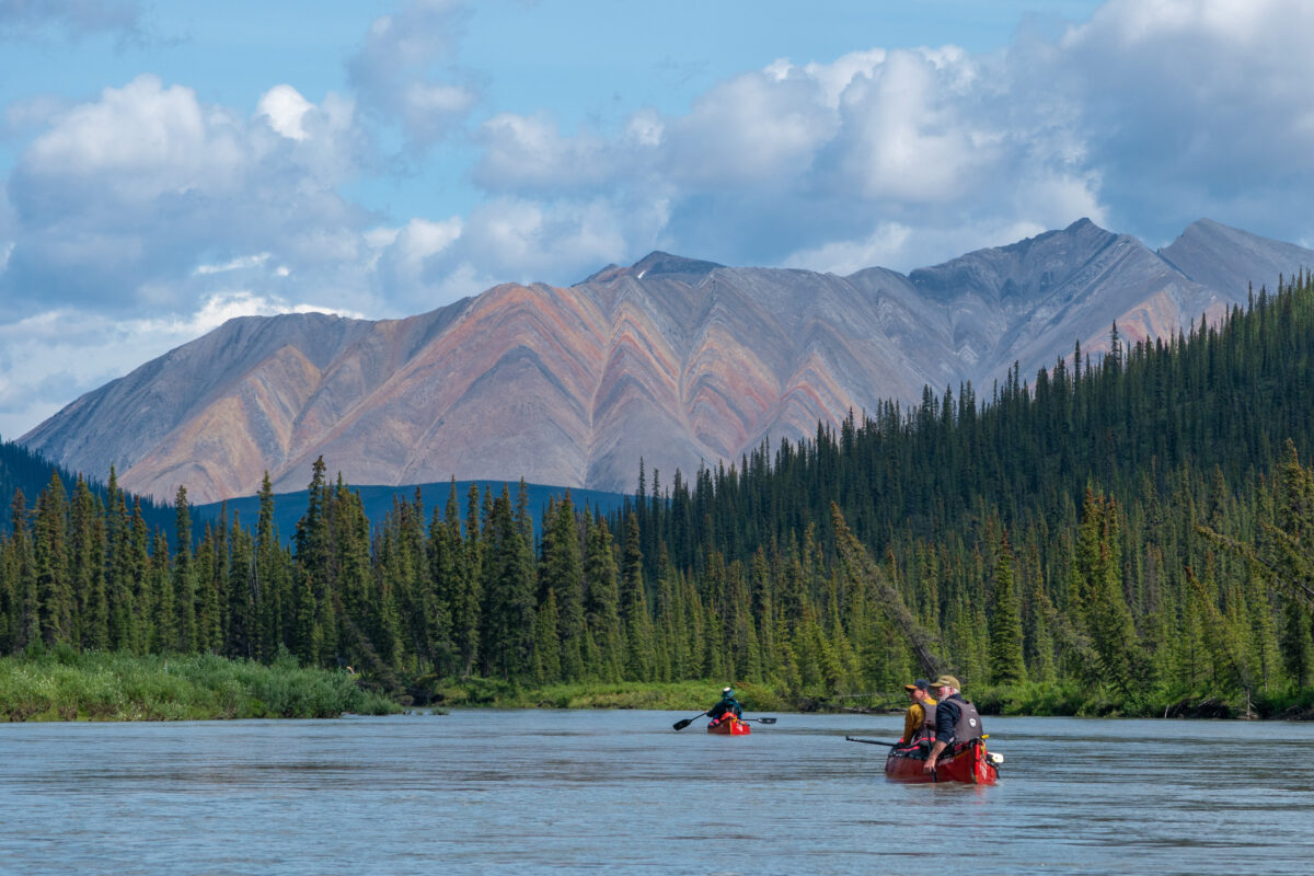
The Keele River is renowned for its striking aquamarine glacial waters and endless braided channels weaving through the Mackenzie Mountains. This remote route offers a stunning journey filled with navigable, friendly whitewater to keep you on your toes.
As the river carries you northeast, you’ll paddle past expansive valleys, jagged peaks and beautiful tributary junctions where crystal-clear side streams pour into the main flow. The changing landscapes from open valleys to mountain corridors keep every day a new thrill on the river.
Paddlers will camp on spacious gravel bars with picturesque backdrops of mountains towering behind tents. Make sure to watch for caribou, grizzly bears, Dall sheep and moose along the shoreline as you drift past. Under the water surface, fishing enthusiasts will find arctic grayling and bull trout hiding in the cold water.
As your journey continues you will transition from steep mountainous landscapes to the broader Mackenzie River Valley with an exciting braiding river and, finally, merging with the Deh Cho (Mackenzie River).
The Canol trail is an incredible route for those looking for a remote, rugged and sparsely utilized route through the mountains. Along the way there are many signs of the pipeline, the reason for construction of the trail during WWII, with many vehicles left in place along the route.
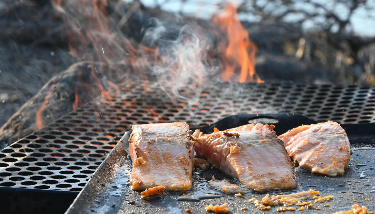
For many paddlers, the treat of freshly caught fish for dinner is sought after. In this region, the most common fish species to catch are: Arctic grayling, whitefish, bull trout, lake trout and northern pike. The diversity of water within the mountain rivers provides rapid, cold water sections, deep pools where tributaries join more major rivers and outflows into slower waters, leading to a plethora of fish habitat.
If you are planning to fish on rivers in the Mackenzie Mountains, you will need a fishing license. Follow the below links to ensure you have the correct paperwork before you head out:
Nahanni Park Fishing License
Northwest Territories Fishing License
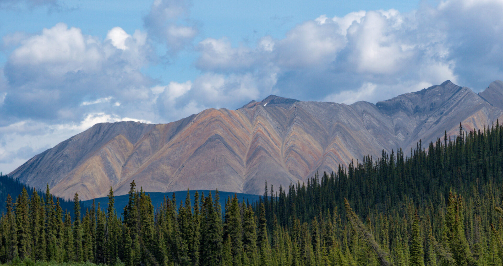
The Mackenzie Mountains are made up of some of the oldest known sedimentary rocks, dating back over a billion years. The mountainous formations were created with tectonic plate shifts leading to land uplift and glaciation leading to U-shaped valleys and rugged peaks. With the variable elevation, the vegetation ranges from alpine tundra in the peaks to densely forested taiga environments in the river valleys. Keele Mountain, located in the Yukon takes the top place for highest peak in the range, standing at 2917m (9570ft) followed closely by the highest peak in the Northwest Territories, Mount Nirvana, standing at 2773m (9098ft).
This region, though known for its paddling routes, is still vastly untouched and leaves plenty of space for wildlife to thrive. Keep your eyes peeled on the shore lines for caribou, grizzly bears, black bears, moose and wolves. Dall sheep are also in the area and may be spotted on a hike up to higher altitude if you get the chance. Bird species are also plentiful in this region with a whopping 150 known species including raptors such as golden eagles, bald eagles and peregrine falcons.
You’ve decided to plan a trip to the Mackenzie Mountains- great! There are many variables to consider in the early stages of planning.
Jackpine Paddle leads guided trips through the Mackenzie Mountains on the Nahanni, Keele and Natla. With this option, your paddling gear, safety gear, food and route navigation are covered. Feel free to reach out to us to discover which route may be best for you!
If you decided to plan an un-guided expedition with a skilled group of paddlers, consider picking up a rental canoe and paddling gear from Jackpine Paddle in Norman Wells (Natla or Keele Rivers) or Fort Simpson (Nahanni River).
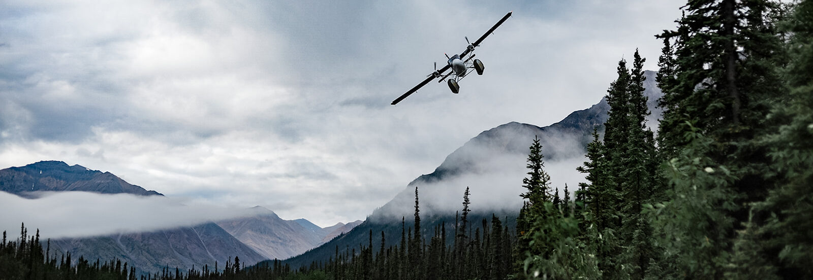
Three common access communities, depending on the charter you’ve booked and the rivers you are aiming to paddle are: Norman Wells (accessed with a flight from Yellowknife), Fort Simpson (accessed by driving or flying from Yellowknife) or Mayo (accessed by driving from Whitehorse).
For rentals in Fort Simpson, we are proud to be in partnership with Liidlii Kue First Nation (LKFN). LKFN represents the Liidlii Kue got’ine people in the community of Liidlii Kue (Fort Simpson) or “the place where rivers come together”.
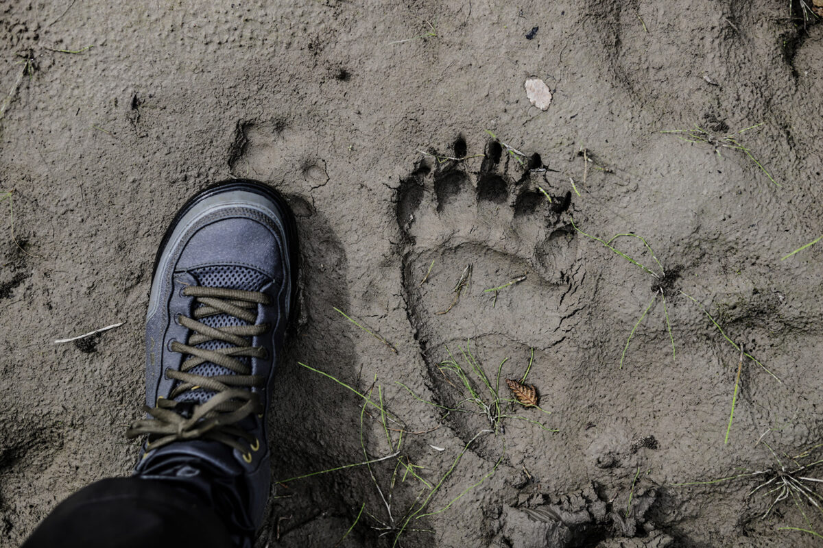
Bears: These are remote regions with bears that do not often engage with humans. To keep it this way, all travelers through this region should be bear safe. This means, storing food away at night, keeping a clean workspace when cleaning fish, and being conscious of recent bear activity signs when deciding on a camp for the night.
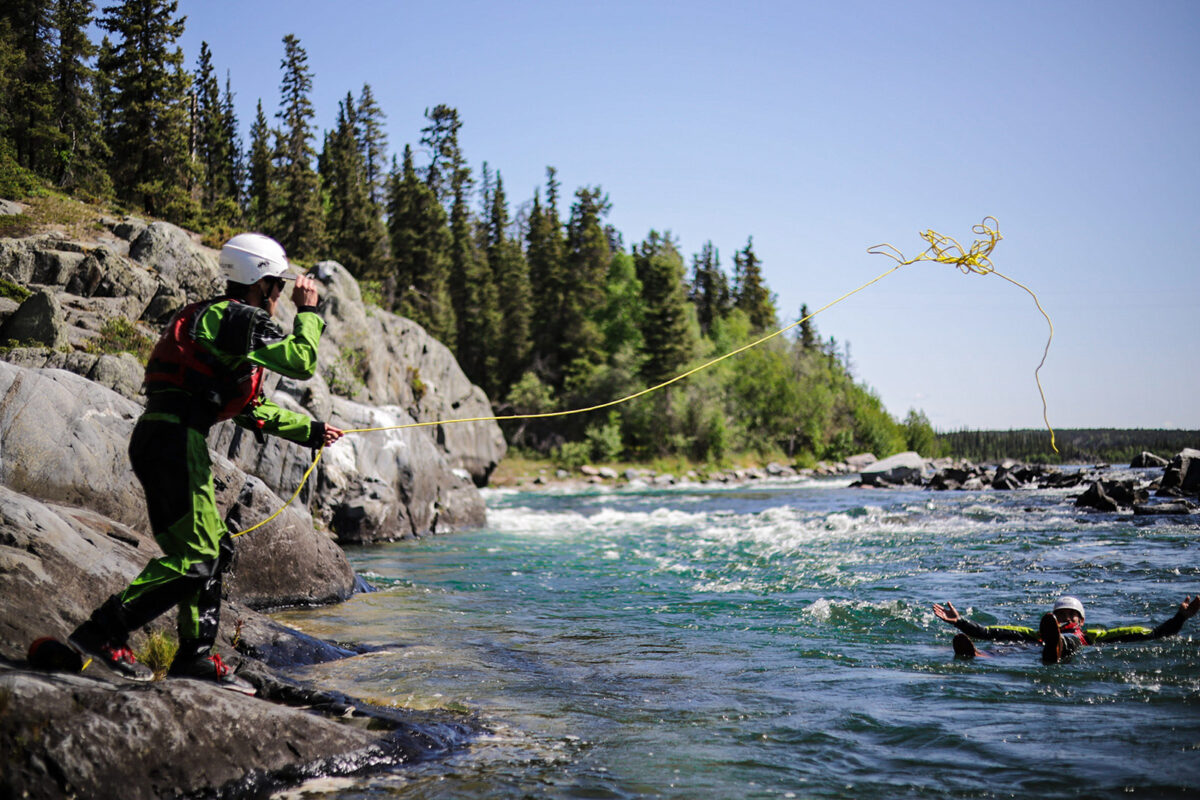
Rescue ready: These are fast-paced rivers that can carry a canoe for many many kilometres before it settles in an eddy or on a tree hanging over the river. If you’re on a guided trip, your guides will have a rescue plan in place and will explain it to you. If you are on an un-guided trip, all canoes in your group should be set up for a fast-paced rescue to ensure the people, gear and canoes are all brought safely and efficiently to shore following a capsize.
Water Temperatures: These mountain rivers are fed by snow and glacial melt from the Mackenzie Mountains. Despite the air temperature ranging from 0°C to 30°C in the summer, the water remains cold throughout the summer season, varying river to river between approximately 5°C to 15°C. Immersion gear such as drysuits or wetsuits are essential for safety on these expeditions.
Remoteness: These are remote rivers with a low chance of seeing other groups on some of the less-popular routes. It is essential to have remote communication devices such as satellite phones and in-reach/spot devices for emergency response if needed. That being said, the emergency response time can vary in these remote places, so having a thorough expedition level first aid kit is necessary for each paddling group. If you are on a guided trip, this will be taken care of by your guides.
The summers are short but beautiful in northern Canada. The paddling season typically runs from July to early September with July having warmer temperatures and late-August/early-September more in line with fall-like temperatures. Water levels are typically higher in July and drop throughout the paddling season. This can change the river features so paddlers must be able to adapt to the river features present during their expedition.
For remote expedition seekers, whitewater thrill seekers, birders, fishing fanatics, wildlife chasers and history buffs, this region has it all.
These routes travel through the wondrous Mackenzie Mountains through river valleys, canyon sections and braided routes all while flowing past the jagged mountainous landscape towering above.
These rivers are on many paddlers’ bucket lists for a very good reason.
Come see for yourself!