2020 was a strange year; this will be a strange trip report. As a global pandemic engulfed the world – the Canadian North closed borders to leisure travellers. In a flash, the North was sealed away. It was now even more inaccessible than ever before.
Within the North a “travel-bubble” was opened between the Northwest Territories & Nunavut. Within these two territories Northerners had plenty of space to roam in a massive 3,182,722 square kilometres of remote wilderness. A backyard big enough to fit California seven-times, shared by only 76,000 residents.
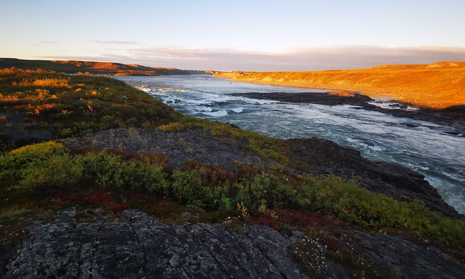
Rising from Lac de Gras in the NWT and flowing 845 kilometres to Nunavut, the Coppermine River crosses the Arctic Circle on route to emptying into the Coronation Gulf, an arm of the Arctic Ocean. At the river’s mouth is the Copper-Inuit community of Kugluktuk.
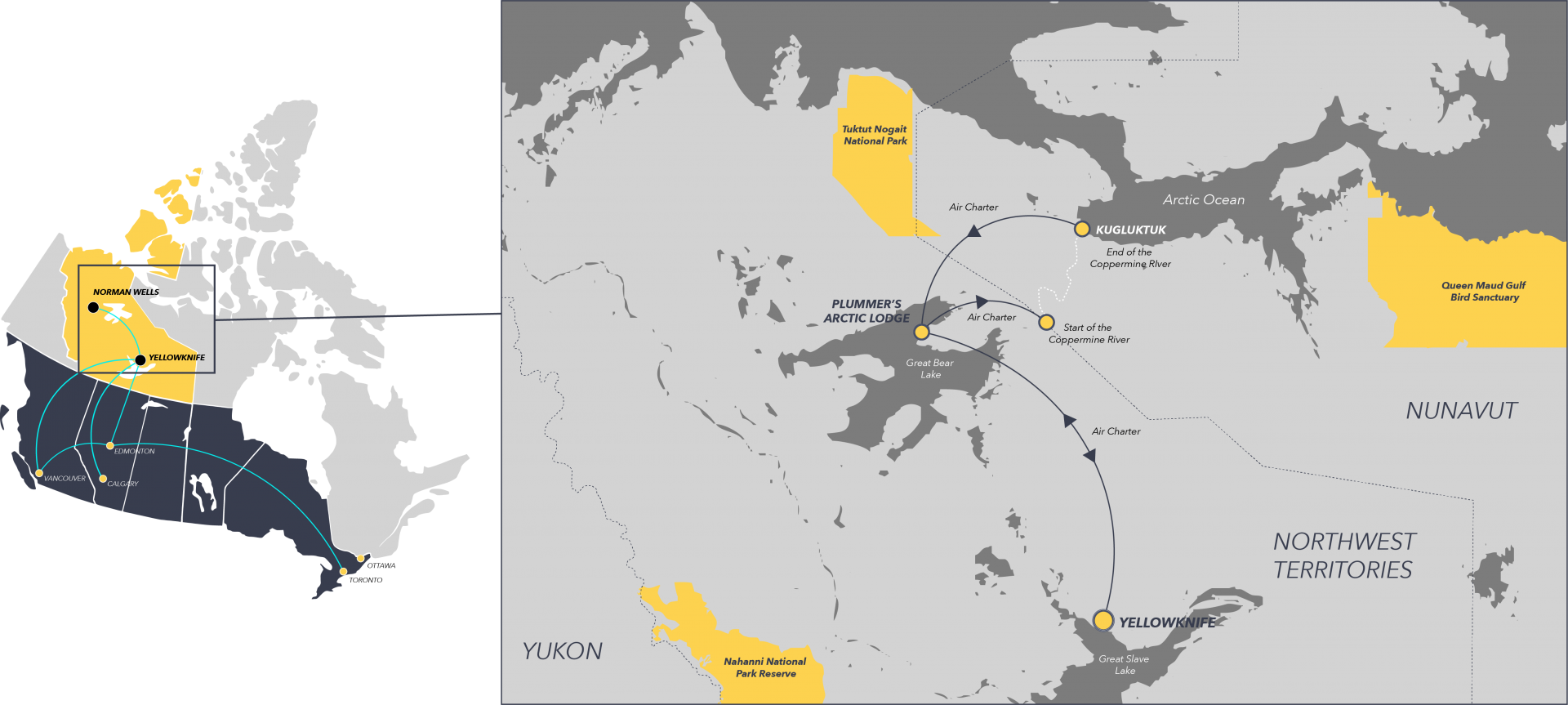
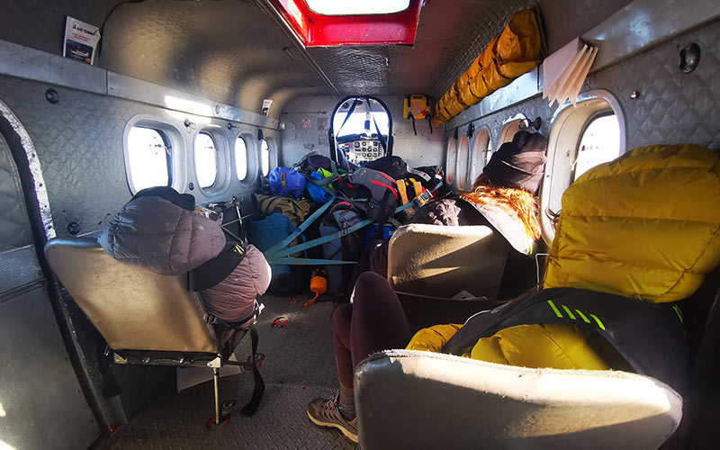
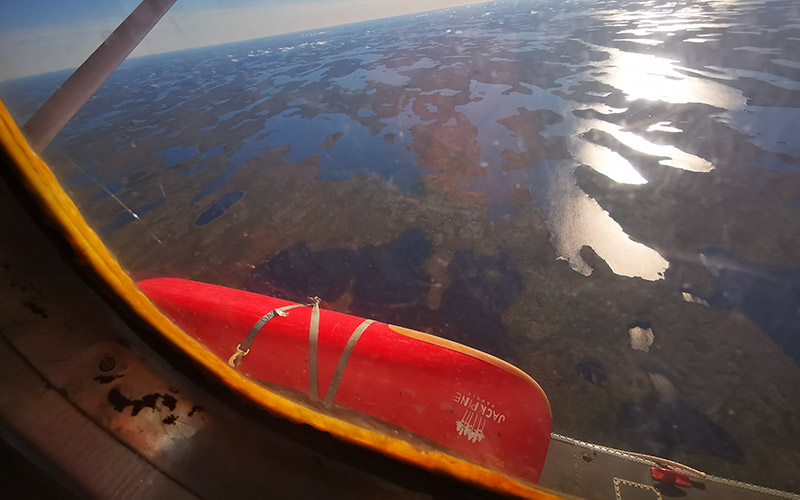
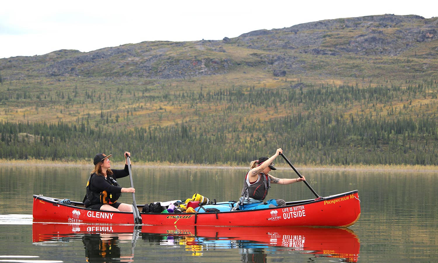
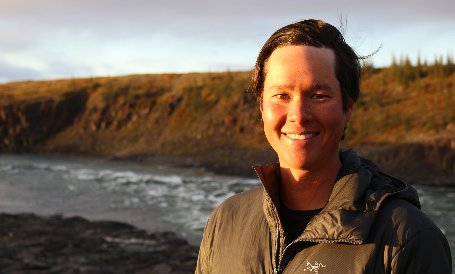
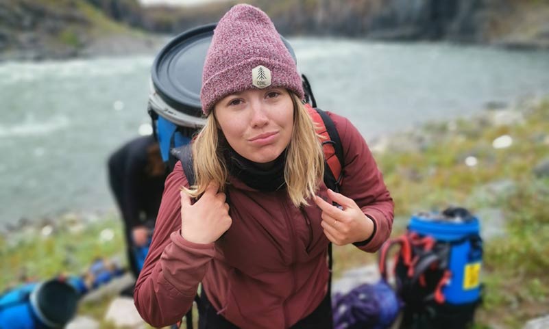
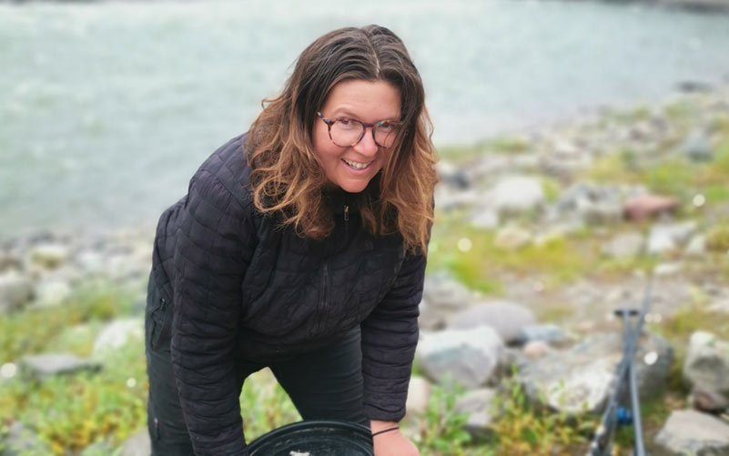
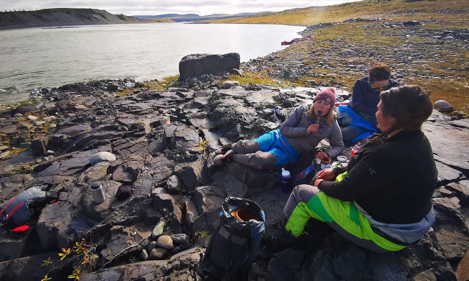
Our party consisted of four paddlers and two canoes. As the guide I led 3 guests from Iqaluit: Jodi, Jackie and Eva. After two days of whitewater canoe training in Yellowknife, we loaded up into a single otter float plane and roared up and away.
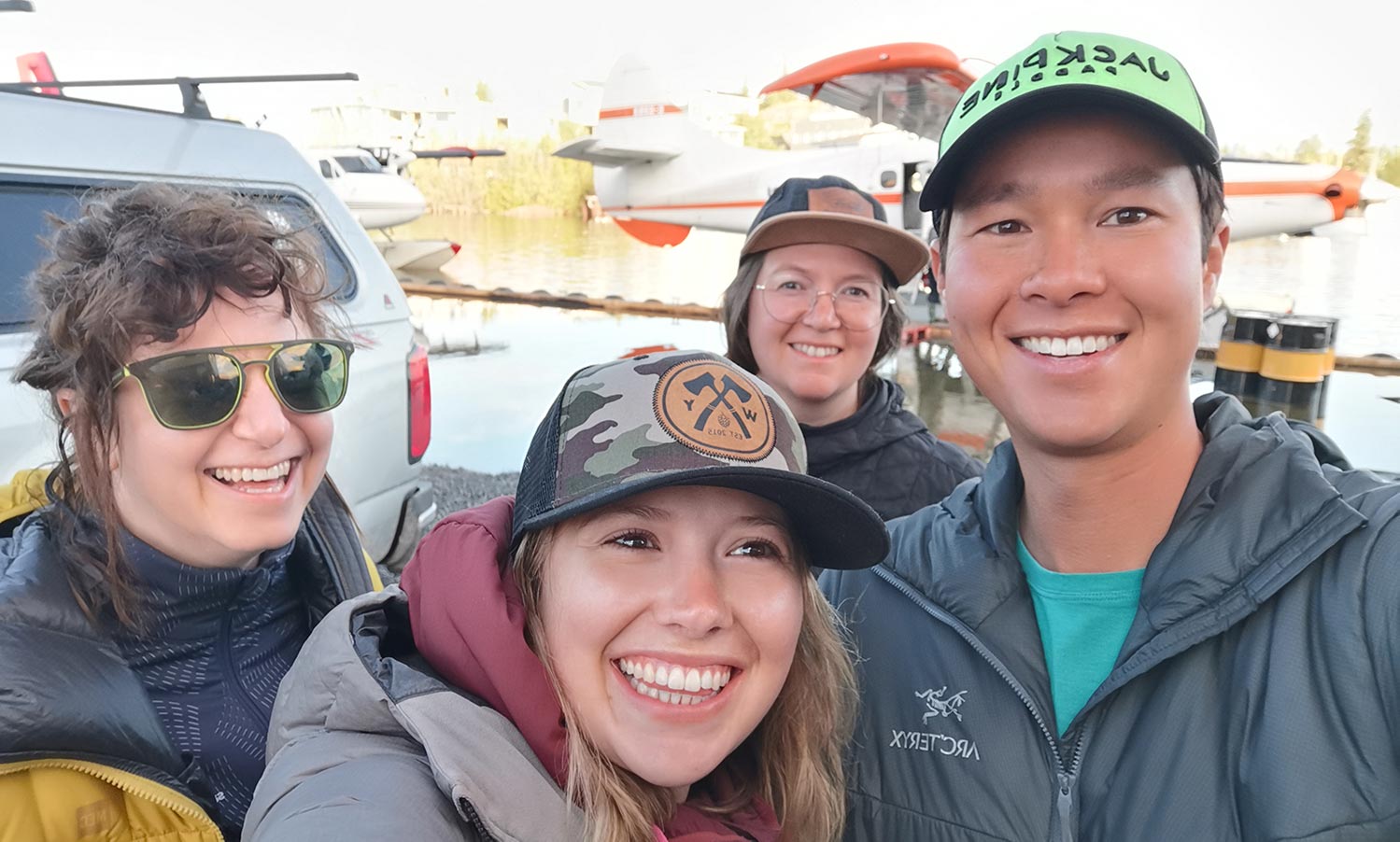
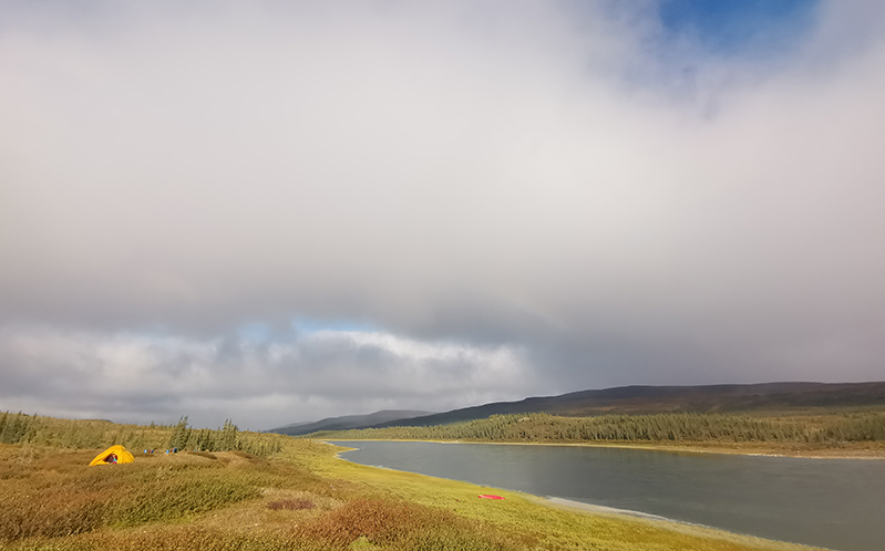
We landed on a calm section of the river about 2 kms downstream from the Fairy Lake River confluence. It was about an ideal beginning to the trip as a canoeist could wish for. No bugs. Sunny days. Warm, peaceful weather under a stable, high pressure system.
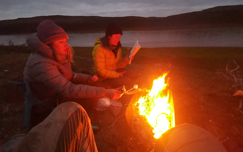
On our first three blissful days of paddling we covered 20 km, 47 km and 36 km, respectfully. At times we floated leisurely and all got sunburned. Each night we entertained each other with tales in the ambience of the campfire.
We became friends.
Remarkably but unsurprisingly, we were the only group to canoe the Coppermine River in the summer of 2020. We celebrated this feat with an inscription in an old cabin alongside many others from years past. I bet it’s been decades if not centuries since the river has been this quiet.
The Coppermine is relatively well-known – at least for a northern river. It’s a historic route to the Arctic used by the early Copper Inuit and explorers George Douglas, Samuel Hearne and Sir John Franklin.
Fortunately, it’s rare to bump into other paddlers even in a “busy year” due to the remoteness of this tundra route.
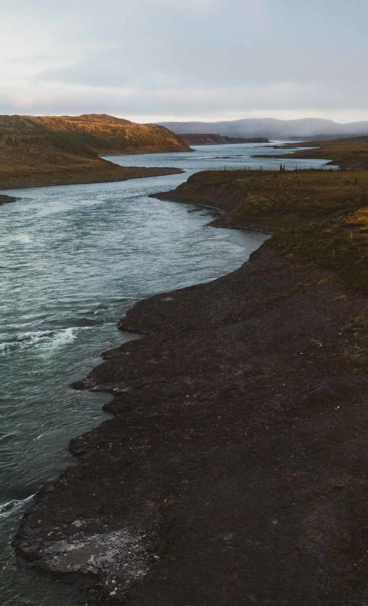
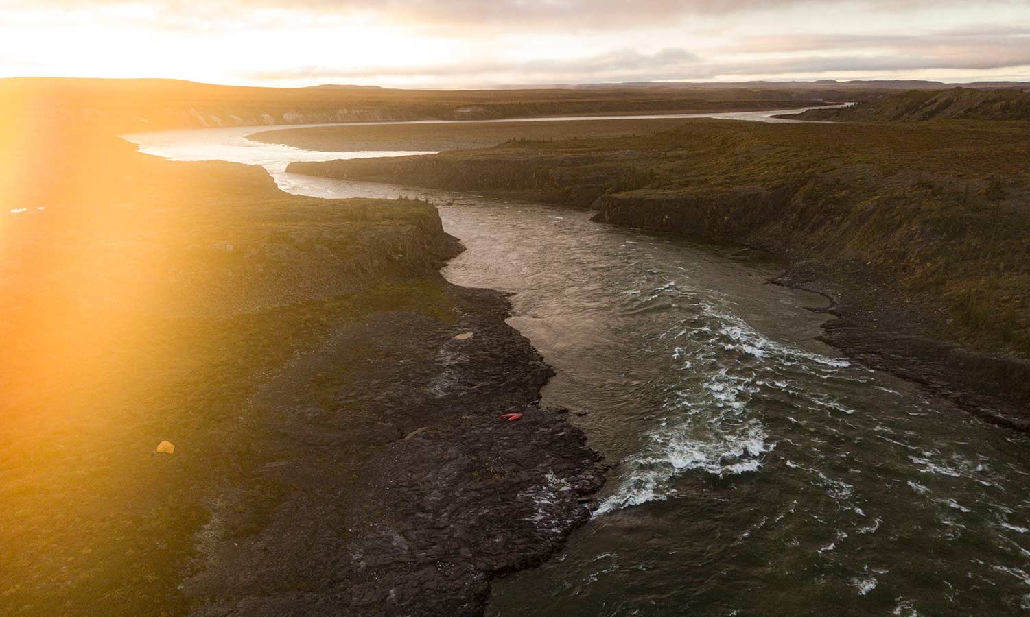
We hit our first whitewater of the trip just past the “Big Bend”. where the Coppermine River turns in the direction of the Arctic Coast.
At Big Bend, the river takes a sharp turn to the northwest, cutting through the Coppermine and September Mountains. The river is very fast for 32 km (20 mi.) through the narrow wooded gorge to Rocky Defile.
I was glad Jodi, Jackie and Eva had taken one of our whitewater canoe courses earlier in Yellowknife. There would be lots of opportunity now to put that training to good use.
We had a sense from the water survey station data and looking at the shore banks that the river was high. At the end of the trip when in Kugluktuk locals mentioned that it was higher than anyone could remember. It wasn’t just high, it was historically high.
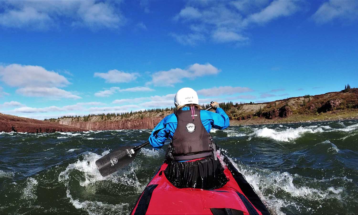
Drysuits, helmets and spray-decks became mandatory. So did careful scouting, back-up planning and the execution of our strokes and maneuvers.
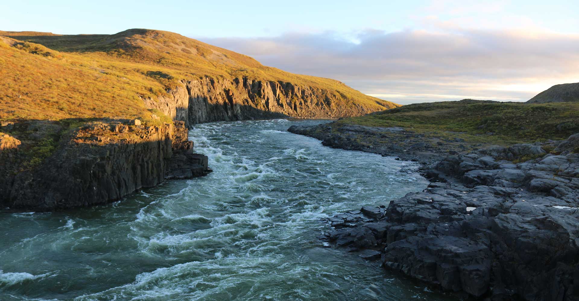
The water was cold and it was pounding down the canyons and rock banks, creating large waves and frothy holes. In a normal season, historic Sandstone, Muskox and Escape Rapids are big volume rapids demanding both caution and expertise by intermediate or advanced canoeists.
We partially ran Rocky Defile (67°02’00.3″N 116°12’18.7″W) & Muskox rapids, opting to partially portage.
Rocky Defile is portaged and scouted on river right. We pulled out 2/3rds down the canyon using an eddy on river right, resulting in a much shorter portage. In a normal year, we would run this rapid. Once through, enjoy some fast current for another 6 km past Rocky Defile.
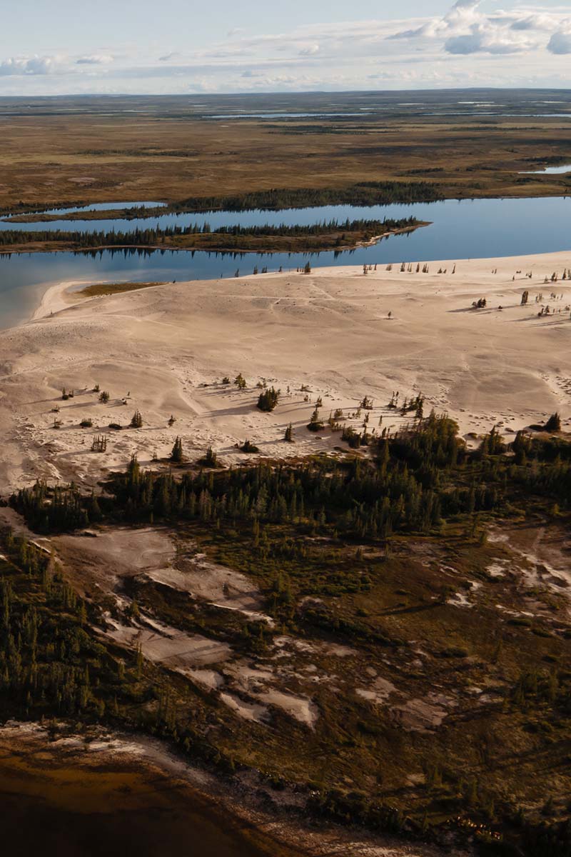
Past Rocky Defile, the river gradually opens into a plain where the Kendall River flows into the Coppermine. Here the trees are much shorter in size and numbers, giving way to the tundra vegetation of grasses, lichens and sedges.
The river widens into boulder flats south of the confluence with the Kendall. There is a fairly open route along the east bank, switching over the left before the big island of the river mouth. The wide Kendall River Valley forms part of the caribou migration corridor. Early explorers used the Kendall to take them to Great Bear Lake via the Dismal Lakes and Dease Arm.
The spruce groves dwindle away to tundra vegetation but it is a more lush growth than is found beyond the valley boundaries. We noticed the steep cliffs and rock that dominate the region north of the Coppermine River Mountains, providing excellent breeding grounds for falcons and hawks. Muskox, swan and arctic fox also make this area their home.
It’s good to note that Muskox rapids is incorrectly marked on the NTS 1:50k topographic maps. Rather it is 4km downstream where two swifts are marked, about 1km downstream from a large island that splits the river (1k in diameter). At low to medium water levels you can run Muskox on the far river left. The alternative which we took would be to portage from an eddy in the middle of the rapid on river left. You also scout it on river left.
At Sandstone rapids we hit an exciting line just left of centre, dodging towering haystacks.
We had some really close calls, but avoided any major mistakes. I was grateful for the attitude, skill and endurance of the group. Most capsizes along the major rapids would have resulted in a long and cold swim.
On the bright side, the high water made for some spectacular campsites perched high above the powerful whitewater.
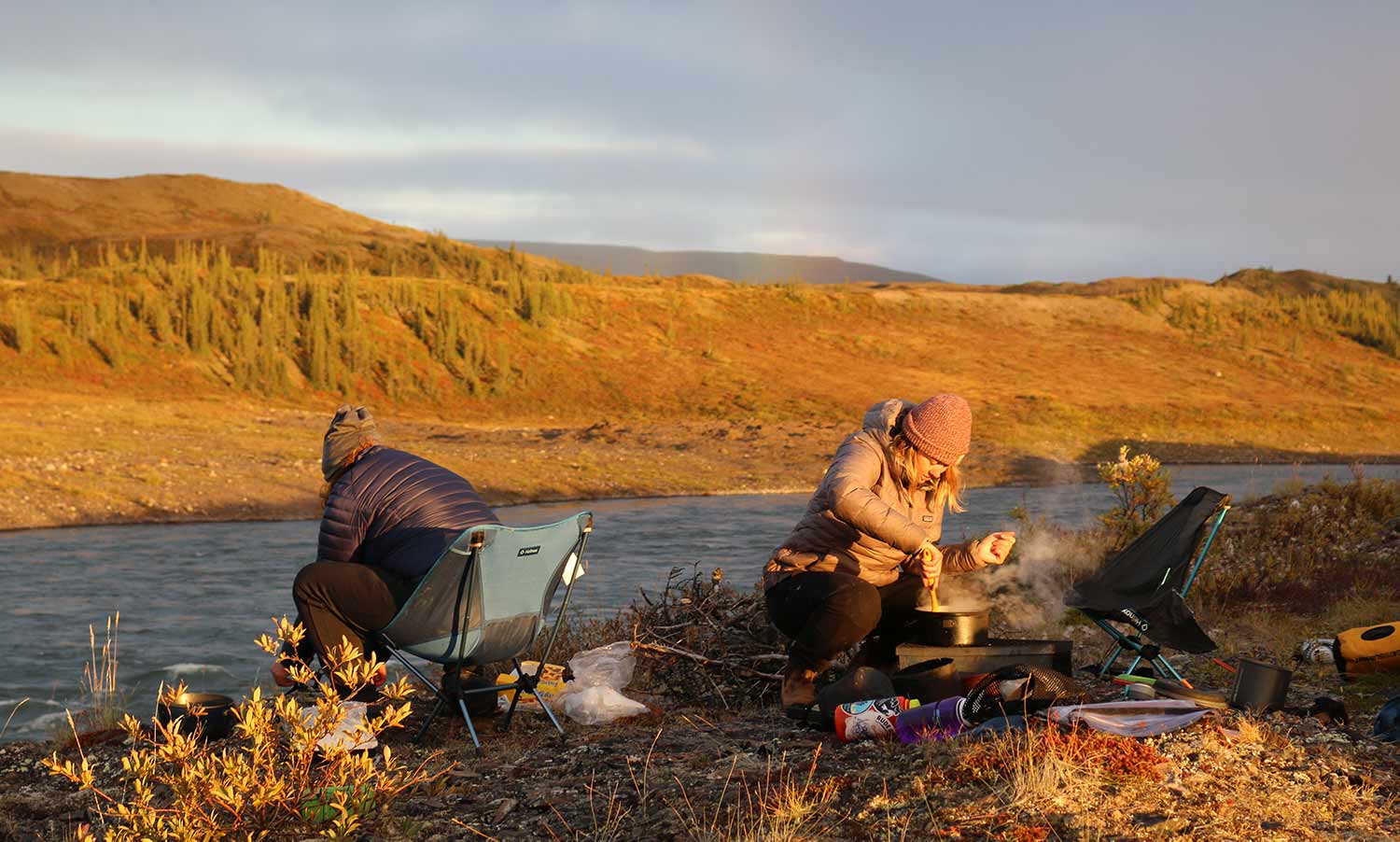
The weather turned a bitter cold.
After a heroic portage around Escape rapids, we arrived at Bloody Falls. These days it is known as Kugluk Falls, an important site for the Copper Inuit in Kugluktuk.
Despite NTS maps showing the portage on river left at Kugluk Falls, it’s actually on river right.
Kugluk Falls is a territorial park in Nunavut. You’ll find some facilities such as tent pads and an outhouse. You are likely to meet friendly locals at from Kugluktuk who take advantage of the scenic fishing opportunities at the base of the rapid. Kugluk Falls is about 10km out of town – connected with a 4×4 trail.
If you can remember one thing from this Coppermine River trip report, it’s that you don’t want to miss the Kugluktuk Visitor Heritage Centre with its impressive stock of regional arts and crafts for sale.
On our guided trips we plan an extra day in Kugluktuk to explore the town. This allows us to participate in a cookout to listen to stories of the land and life in Kugluktuk from a respected local tour operator.
GETTING TO THE TRIP
If you considering a trip on the Coppermine River, we’d be pleased to assist you with booking one of our guided trips.
For those wondering how to get to the trip, Ii has never been easier to fly to the Northwest Territories. You may be able to use your airline reward points such as Westjet Dollars or Aeroplan points. For those with time on their hands who enjoy road trips, driving is also an option with a paved, all-season highway connecting Yellowknife to the rest of Canada.
By air, major airlines fly to Yellowknife from Edmonton/Calgary, including WestJet and Air Canada. Seasonally, you can find direct flights from Ottawa through Air North, and Vancouver from Air Canada.
By road, it’s a 19 hour drive north from Edmonton along the MacKenzie Highway through 1500 kilometers of forest and wilderness, where you may catch glimpses of bears, bison and other wildlife.
MAPS
If you would like to order maps to have your own, the 1:250,000 topographical maps are:
Coppermine 86 O, Dismal Lakes 86 N, Sloan River 86 K, Hepburn Lake 86 J
You may also want to consider more detailed 1;50,000 maps for more accurate navigation.
SUGGESTED READING:
The following are some relevant books for winter reading:
Beyond this Coppermine River trip report, see this article I wrote in May 2017 to help those planning their own adventure (Please note is was written in a low water year). We can assist you with canoe & gear rentals.
If you are looking for a guided canoe trip, you can book a spot on a future trip here!
Day #1 – August 23, 2020. Distance: 20 km-ish.
Eva, Jackie and Jodi were sitting on the Niven lake curb when Dan #jackpinepaddle picked us up, making our way to Air Tindi. After Eva downed a 7:30am diet pepsi we were on our way, in a float plane, past Rocknest Lake, landing on the Coppermine. After putting our nested canoes back together and a failed tiktok of the floatplane we were off, paddling approx 20km before pulling up on a rocky beach and figuring out where all our stuff was in the barrels. A little Rockin Morrocan stew with naan and we were fast asleep.
Day #2 – August 24, 2020. Distance: 47km
The day started off foggy but cleared up as we got on the water around 10am. The sun was shining and everyone got a sunburn. We later found a mostly broken down cabin (maybe haunted) we wrote the 2020 COVID Coppermine canoe crew (exclusive) on the cabin #jackpinepaddle.
Day #3 – August 25, 2020. Distance: 36km
Today we made up ground towards the big bend, ending the day at an old trapper’s cabin near a hilly S-bend in the river back by a double-eddy. A moose cow was spotted near our camp. We paddled from 10:45-6:40pm. At times we floated leisurely, discussing the inner politics of book clubs in Iqaluit. Gnoochi and smores put a cap to the wonderfully fun sunny overcast day.
Day #4 – August 26, 2020. Distance: 41Km
We have crossed many important thresholds on this journey, among them the Arctic Circle – this is Jackie’s first time above the Arctic Circle. When we got to Big Bend (aka Big Ben, aka the only landmark Jackie and I have in our minds) I asked Jodi if we were at Big Bend and she said “Ehm”. Today was grey and windy and the river got serious after Big B. We hit some white water, but apparently not actual rapids. Something about swifts, currents, haystacks and who knows what else.
We picked up a ghost at the last camp named Bjord or Bossimo, depending on whether he is German or Italian. We found his glove at tonight’s camp. I guess he is missing a hand. Today was our first day in Dry Suits and Dan used his “guide voice”. We are more than a day ahead of schedule. Camped at a lovely spot that is not Rocky Defile.
Day #5 – August 27, 2020. Distance: I didn’t write it down…
After much procrastination, physical, emotional, and spiritual preparation, we entered the day with buoyant smiles and ended the day with even more laughter. The sandwich meaty part of the day – well, that’s a story. Arriving at the canyon that is the entry of Rocky Defile, we pulled up RR and took our time to scout high from the cliffs above. Dan and Jodi discussed guide-y things with furrowed brows mixed with eager anticipation. It was decided that Jackie and Dan would confess their sins and make their way RR to spot with a safe eddy. This was a test run (while Jodi and Eva were pack mules for heavy barrels) and waited as “safety” at the bottom, throw bag in hand for Jodi and camera for Eva.
Barely making it through without being defiled by a haystack or rocky edge, they eddied out and eyes wide, it was decided we best portage the rest. After our first hot ichiban lunch we set off grateful to have our friends/family erect a monument for anyone on this trip (a general goal). We pulled up at Kendall river and a very muddy site with fresh-ish bear prints and poop, settled in for the night of scotch and group reading around a fire.
Day #6 – August 28, 2020. Distance: 36km
We all woke up late in the bear habitat. We decided to make camp in << insert childlike drawing of a bear>>. First, I got my lure stuck under a stick in the water. On my rescue mission I lost both my sandals. Dan got them out. Next we paddled about 5 hrs and pulled over for camp. It was the first time in 2 days I felt warm. We had Thanksgiving dinner. There was a lot of planning on making it.
Day #7 – August 29, 2020. Distance: unknown
Bonded by growing familiarity with each other, it was easy as ever to lose perspective. 4 people, deep in the remote wilderness of the Western Arctic. This trip will end, as they all do. But I’m not sure any of us want it to. Looking forward to getting back on the river tomorrow. Smiles are buoyant!
Day #8 – August 30, 2020. Distance: 27 km
We planned to wake up early and hit the river. We woke up at 9:30am. We were on the river at 11am. Next up we saw a real live actual Muskox! It was on RL and it looked at Jackie in the eyes. We pulled over and went a-hunting. We did not see the muskox again. We spent the rest of the afternoon wondering if we had made it to Muskox rapids. After several false guesses, we made it to the rapids. There were no muskox. However, it was very sunny so I re-named them Sunshine rapids. There was a lot of scouting and eventually we decided to run part way and camp on the portage.
Once we were on land, once camped, we rushed to wash ourselves with soap and water. It was glorious! In other news, it’s Day 8 so Dan has been trying to sew discord, to fulfill his prediction that things get dark on Day 8. I called Jodi a procrastinator and Jackie called me fussy, so I guess it’s all true. Also, the four of us are workshopping a paddle themed erotic novella about Jojo and Bartholemew. Stay tuned! (Dan says we are at one of the most beautiful campsites we’ll ever have in life!).
Day # 9 – August 31, 2020. Distance: 21km
We paddled 21km as the Coppermine River began to lose gradient as it chips down steep-walled canyons toward the Arctic coast. Today was fast & furious as we barely ran huge lines, skirting between on or on top of holes and 1meter-1.5 meter waves, stopping to bail water often. We danced on the fine line between high-fives or long, cold swims and came up on top. I think we got on the water around 11:30am and were off by 5pm, stopping for lunch and also scout Sandstone rapids. This part of the river is dramatic and beautiful but requires ample time for scouting, resting and planning/executing routes. I crashed my drone into bushes, right at the top of a 40m cliff across from the river of our camp. Gratefully, Eva instantly volunteered to assist in the rescue mission – including cliff walking and double hero ferry. We all did well as a team today.
Day #10 – September 1, 2020. Distance: unknown
We woke on Jodi’s-Jod’s birthday on a cold fall day. For Jodi’s (J-dog) birthday we sang her a song Eva wrote while going through the rapids. Dan whipped up some G&T’s.
J is for joyful, when she’s paddling the white water
O is for optimist like a fuzzy otter
D is for delightful companion on this trip
I bet you’d agree that Jodi is the shit!
– Eva’s birthday song for Jodi
No entries for Days 11 & 12.